Aditya Sisodia
The team, led by geo-archaeology researcher and authorised drone pilot Javier Fernandez Molina, employed drones equipped with cameras to photograph and record videos of the walls in 18 shallow cavities. These aerial images provided a comprehensive view of the cave interiors, aiding in the identification of potential archaeological sites. The researchers were thrilled to discover two mountain shelters that housed prehistoric wall art.
Among the remarkable findings were vivid depictions of archers, deer, and goats, with some figures portrayed as if they had been wounded by arrows. The abundance of figures within the paintings points to the cultural significance of the site and cements its importance as one of the most noteworthy Neolithic rock art locations in the region.
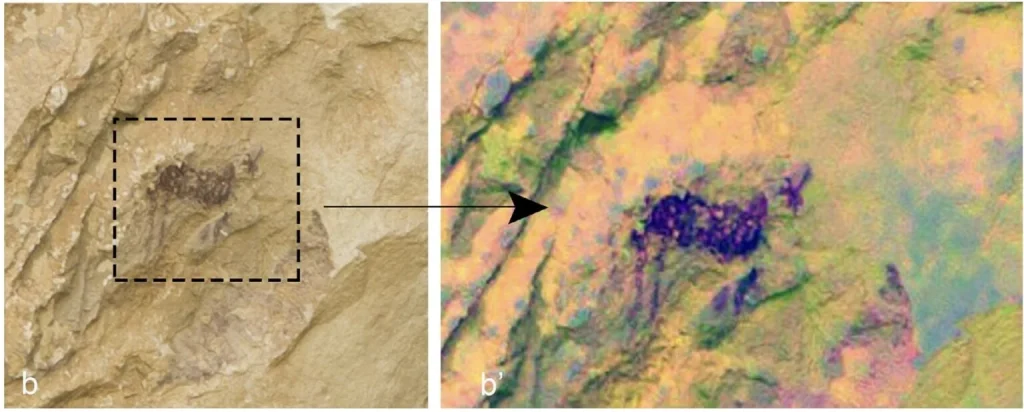
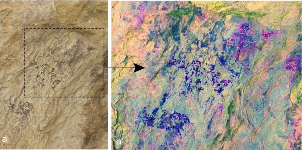
All photos via “Drone detection methodology (RPAS) applied to the prospecting of prehistoric rock art” by Francisco Javier Molina Hernandez, Virginia Barciela Gonzalez, and Ximo Martorell Briz.
The discovery of these ancient cave paintings has profound implications for our understanding of prehistoric human civilisation in the Alicante region. The vast number of figures observed in the paintings underscores the artistic and cultural richness of the Neolithic era. These visual representations provide a glimpse into the daily lives, beliefs, and hunting practices of the people who once inhabited these mountainous landscapes.
By publishing their findings in the scientific journal Lucentum, the research team has shared the innovative methodology and the significance of their discovery with the wider academic community. The use of drones not only expedited the exploration process but also facilitated detailed analysis and documentation of the cave paintings. By employing image-processing techniques such as enlarging and enhancing raw photos in Photoshop, the researchers were able to bring out intricate details and nuances that might have otherwise been missed.
The successful integration of drones into archaeological research opens up exciting possibilities for uncovering hidden historical and cultural artifacts. The efficiency and versatility of drones enable researchers to explore remote and challenging terrains with relative ease. In addition to the identification of cave paintings, drones can be employed to map archaeological sites, conduct aerial surveys, and monitor the preservation of fragile locations.
The utilisation of drones by researchers at the University of Alicante has yielded remarkable results in the field of archaeology. Drones have revolutionised the field of archaeology by providing researchers with an array of powerful tools. These unmanned aerial vehicles enable aerial surveys, allowing for the quick and accurate capture of high-resolution imagery of archaeological sites. Drones can create detailed 3D maps and models, aiding in site documentation and visualisation. Their ability to access remote or inaccessible areas helps researchers explore challenging terrains without physical exertion.
Through their aerial surveys of hard-to-reach mountain shelters, the team discovered ancient Neolithic cave paintings of immense cultural significance. This groundbreaking find underscores the power of drones in unlocking previously inaccessible sites and highlights the potential for further discoveries in the region. As technology continues to advance, drones are poised to revolutionise the way we explore and understand our ancient past. Published in Peta Pixel

